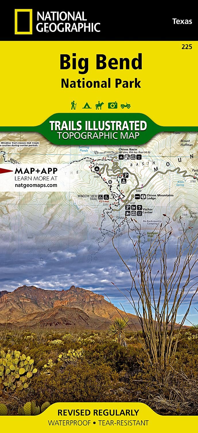
Picture this: you're standing at the edge of the Chihuahuan Desert, the sun baking the rugged landscape of Big Bend National Park. It's remote, wild, and full of surprises—from towering Chisos Mountains to the winding Rio Grande. But in a place this vast, getting turned around on a trail or misjudging a dirt road can turn an epic trip into a headache. That's where this National Geographic Trails Illustrated map (#225) steps in as your trusty sidekick.
Big Bend isn't your average park. Spanning the largest protected chunk of Chihuahuan Desert, it boasts incredible biodiversity and terrain that demands respect. Primitive trails snake through canyons like Boquillas, peaks like Emory rise sharply, and four-wheel-drive roads test your vehicle's limits. Without solid navigation, you're guessing on elevations, campsite locations, or even safe river crossings. Local agencies and National Geographic teamed up to solve that with unmatched detail.
This folded map (4.25" x 9.25" when pocketed, opens to 37.75" x 25.5") is printed on Backcountry Tough paper—waterproof and tear-resistant, so rain or rough handling won't ruin it. Contour lines show elevations, a full UTM grid aids GPS use, and scales (1:133,333 overall, 1:27,500 for Chisos) make distances crystal clear. Key areas like Black Gap Wildlife Management, Sierra del Carmen, and Big Bend Ranch State Park are highlighted. Hiking trails include mileages between junctions; roads are coded (paved, dirt, 4WD, high-clearance); Rio Grande has river mileage for paddlers.
Imagine plotting your route to Sue Peaks or Ernst Valley, knowing exactly where the next water source or viewpoint awaits. Families can stick to easier interpretive trails, while hardcore hikers tackle primitive paths with confidence. Boaters trace the Rio Grande without surprises, and off-roaders pick the right path for their rig. It's not just a map—it's peace of mind in a park where cell service is spotty and self-reliance rules.
On a multi-day backpacking loop through the Chisos, this map helped me link trails seamlessly, avoiding dead ends. Day-trippers to Santa Elena Canyon appreciated the scenic pullouts marked ahead. Even casual visitors used it to find quiet picnic areas away from crowds. Fold it in your pack, glovebox, or kayak hatch—it's ready whenever Big Bend calls. Grab this topo map and turn the park's challenges into your greatest stories.