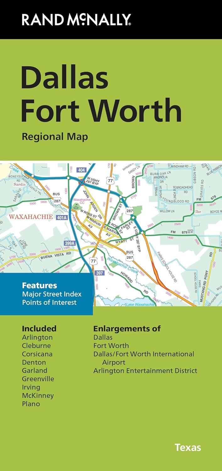
Planning a trip to the vibrant and bustling Dallas Fort Worth area? Rand McNally’s folded map is your indispensable tool for ensuring you get the most out of your travels. This expertly crafted map provides a detailed overview of the region, helping you navigate its extensive road network with ease.
One of the standout features of this map is its unbeatable accuracy, showcasing all major highways including Interstate, U.S., state, and county routes. The full-color design is not only visually appealing but also enhances readability, allowing you to quickly locate where you are and where you need to go. Whether you’re searching for parks, airports, or downtown highlights, this map clearly indicates every essential point of interest.
With an easy-to-use legend and a detailed index, finding your desired destinations becomes a hassle-free task. The additional major street index ensures you’re never lost in a new neighborhood. Plus, with enlarged maps for key locations like the DFW International Airport and the Arlington Entertainment District, you can focus on what you want to explore most.
Measuring 9.5" x 4" when folded, this map expands to a generous size of 40" x 28", giving you a comprehensive view of the entire area without being bulky. It’s perfect for following routes while driving or planning adventures on the go. Each fold carefully designed for practicality means it fits neatly in your bag, ready to accompany you wherever your journey takes you.
Whether you’re a local seeking new hotspots or a visitor exploring for the first time, Rand McNally’s folded map is the reliable companion you need. Experience the ease of exploration and let this map guide you through some of Texas’s most exciting locales. Grab your map and hit the road—Dallas Fort Worth is waiting for you!