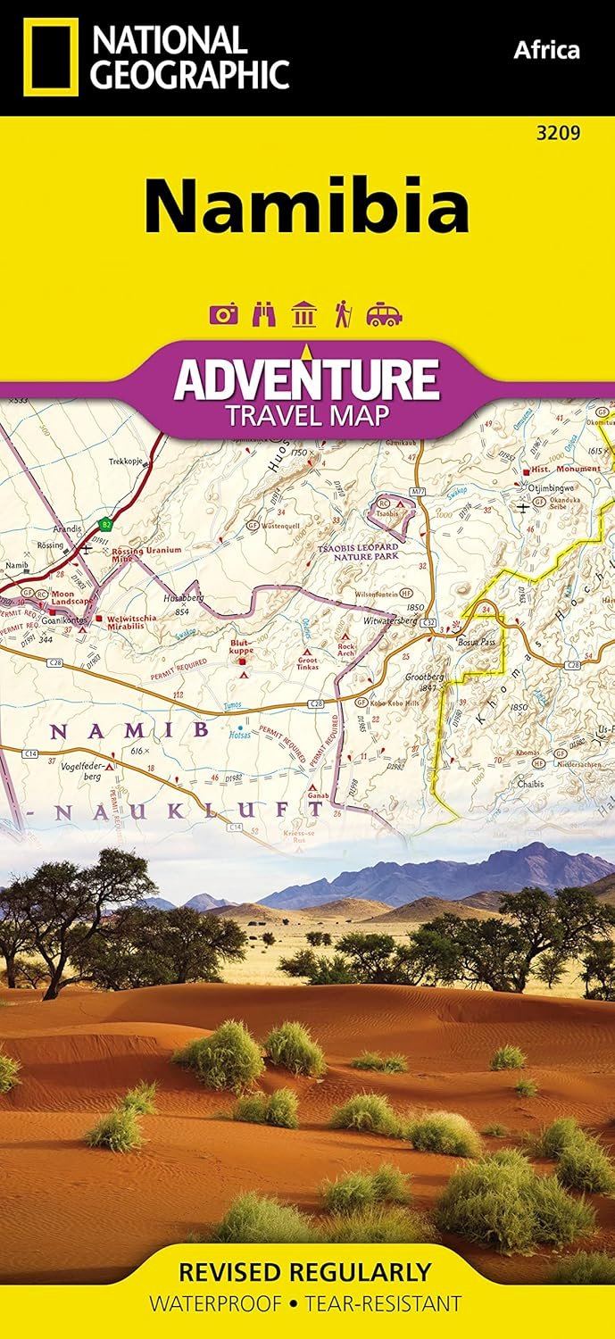
Imagine tracing the endless orange dunes of the Namib Desert or spotting lions prowling the Kalahari's edge—all without losing your way in the heat. National Geographic's Namibia Adventure Map (3209) is built for travelers who crave the real Africa, not just the postcards. Printed on tough synthetic paper, it's waterproof and tear-resistant, shrugging off sandstorms, splashes, and rough handling like it's nothing.
Phones die in the bush, and basic road maps skip the good stuff. This one nails it with a 1:1,200,000 scale covering the whole country, from Windhoek's overlap zone to the Skeleton Coast up north and Namib-Naukluft down south. You'll find every highway, backroad, and dirt track marked with distances, plus hundreds of private lodges, rest camps, and off-grid gems. No more circling lost around a unmarked waterhole.
Picture yourself bumping along the Tsau//Khaeb National Park border, map flapping in the breeze but holding strong. Or hunkered in your tent during a coastal fog, plotting tomorrow's Skeleton Coast hike. It's not just a map; it's your ticket to 15% of Namibia's protected lands, where the desert meets the sea in jaw-dropping drama. Travelers rave about how it reveals guest lodges tucked away from crowds, turning a road trip into a safari.
Whether you're self-driving from South Africa or flying into Windhoek for a overland trek, this map answers 'where's the next camp?' and 'how far to the dunes?' Grab it for your next journey—it's the quiet hero that lets the landscape steal the show.