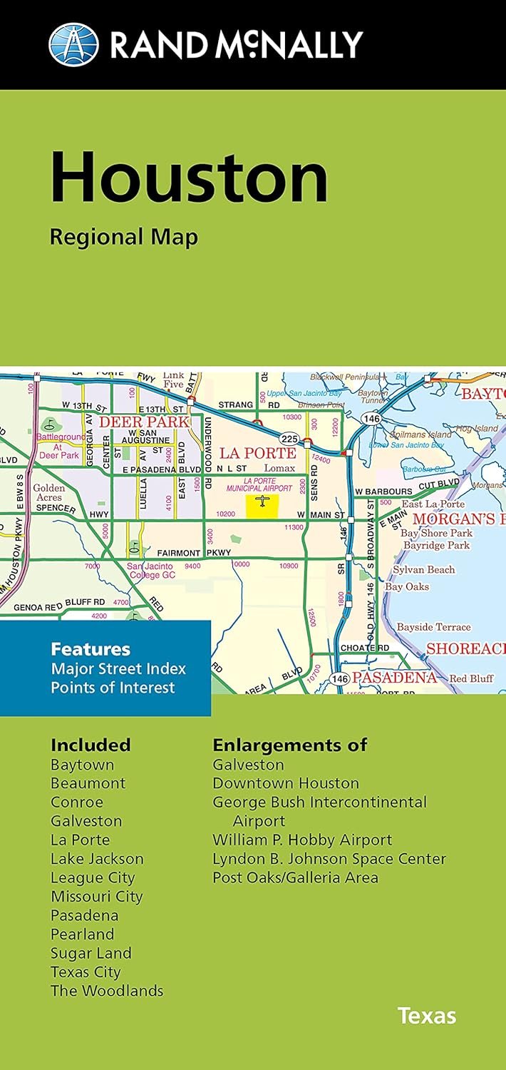
Explore the vibrant and bustling city of Houston with the Rand McNally Folded Map, a trusted resource for travelers and locals alike. With a focus on clarity and ease of use, this folded map presents expertly crafted cartography that captures every detail important for navigation.
This map meticulously outlines all Interstate, U.S., state, and county highways, allowing for smooth travel across the city and beyond. In addition to the highways, the map also highlights parks, points of interest, airports, and county boundaries, ensuring you have all the necessary information at your fingertips. Whether you are planning a trip or simply exploring the city, this folded map stands out as an essential guide.
The Rand McNally Folded Map features an easy-to-use legend, providing quick reference points and information to assist in locating your desired destinations effortlessly. With a detailed index, you can swiftly find street names and sites of interest, making this map an invaluable companion whether you’re commuting, sightseeing, or enjoying a leisurely day out.
For years, Rand McNally has been synonymous with quality and reliability in mapping, making this folded map a must-have for anyone who values clear, concise, and accurate navigation in Houston. Don’t get lost in the city’s hustle and bustle; let Rand McNally be your guide to discovering all that Houston has to offer!