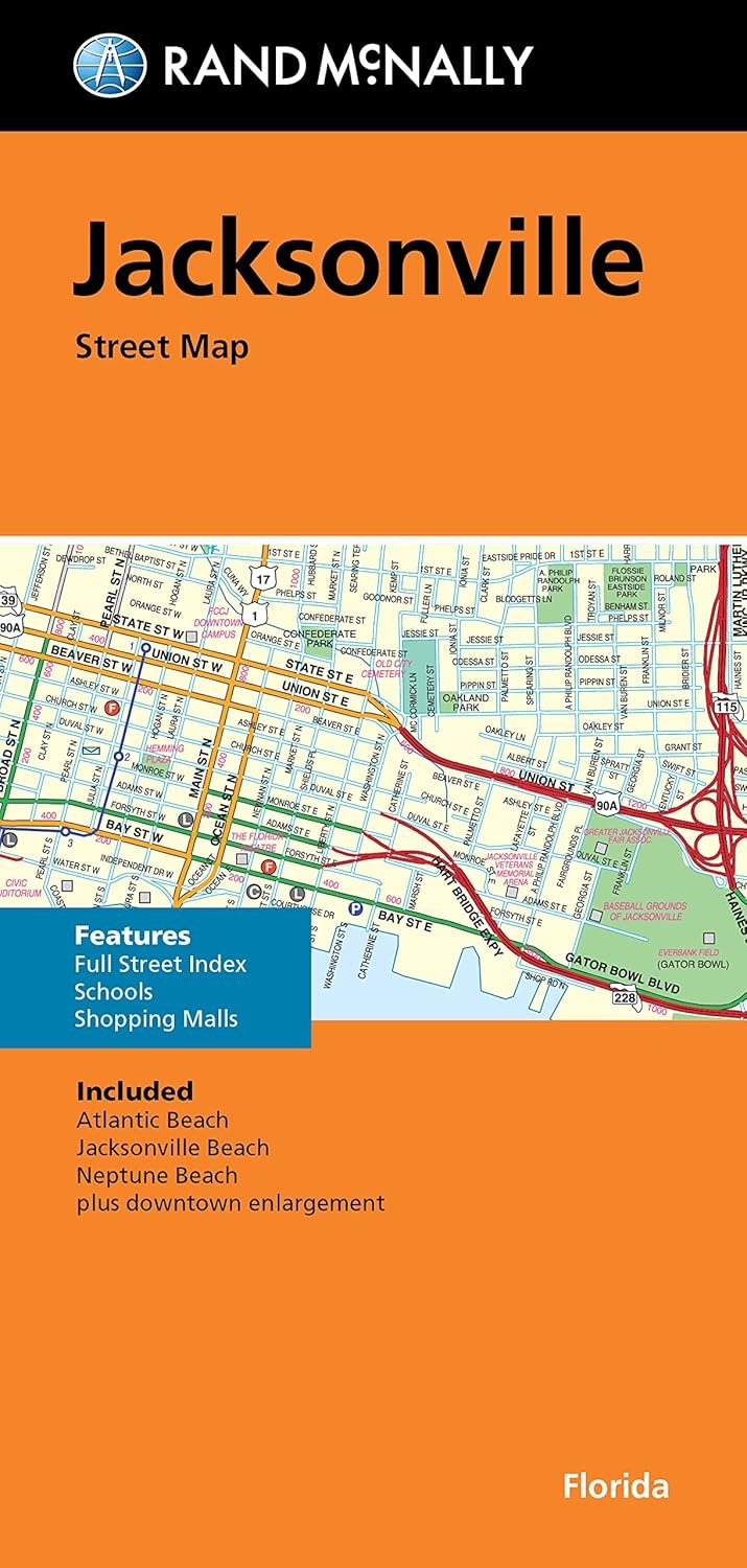
Traveling around Jacksonville, Florida? Look no further than the Rand McNally Folded Map, a reliable travel companion that promises unbeatable accuracy and quality at an amazing price. Renowned for its detailed representation, this folded map includes all major highways such as Interstate, U.S., state, and county routes, providing you with the most comprehensive coverage available.
With colorful and easy-to-read maps, you will not only locate highways with clarity but also discover parks, points of interest, airports, county boundaries, and essential facilities like schools and shopping malls. Special attention has been given to downtown and the surrounding areas with enlargement maps, making it effortless to navigate even the busiest locales.
The map features an easy-to-use legend, enabling travelers to find their destinations swiftly without getting lost in a sea of information. The detailed and full street index is great for pinpointing specific locations, giving you the confidence to explore with ease.
Completely updated for accuracy, this folded map measures a convenient 9.5 x 4 inches when folded and expands to a generous 40 x 28 inches. You'll benefit from a functional design that fits perfectly in your pocket or glove compartment while providing ample information when laid out. Whether you're visiting Atlantic Beach, Jacksonville Beach, or Neptune Beach, this map is your perfect guide. Experience how Rand McNally has remained the trusted standard in cartography for years by ensuring your adventures around Jacksonville are always beautifully mapped out!