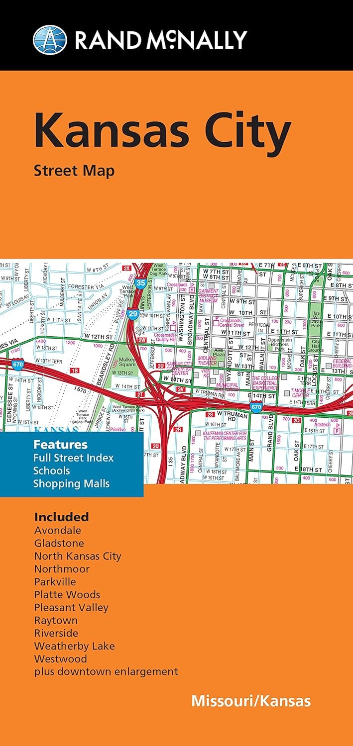
Traveling around Kansas City, Missouri, is now easier than ever with the Rand McNally Folded Map. Known for its unbeatable accuracy and reliability, this map has become a trusted resource for travelers, making it essential for both locals and visitors. Measuring 9.5' x 4' when folded and a generous 40' x 28' when opened, it is designed for easy carrying and quick reference during your travels.
This full-color map showcases all the essential routes, including Interstate, U.S., state, and county highways, helping you navigate the city without hassle. In addition to the extensive highway coverage, the map also highlights parks, points of interest, airports, schools, shopping malls, and even detailed maps of downtown and surrounding areas. Each element is clearly labeled, ensuring that you have all the information you need at your fingertips.
One standout feature of this map is its easy-to-use legend and detailed index, allowing you to locate destinations quickly. Whether you are looking for a specific attraction, or just exploring the neighborhoods, this map guides you through Kansas City’s urban landscape effectively. The communities included, such as Avondale, Gladstone, Grandview, and Riverside, are well represented, making this map not just a travel tool but also a great resource for discovering local hidden gems.
Regularly updated to reflect any changes in the area, Rand McNally's maps are synonymous with quality and detail, ensuring that you always have the latest information on hand. So pack your bags, grab your Rand McNally Folded Map, and get ready for your next adventure! With this map, you won’t miss any exciting attractions or scenic routes Kansas City has to offer.