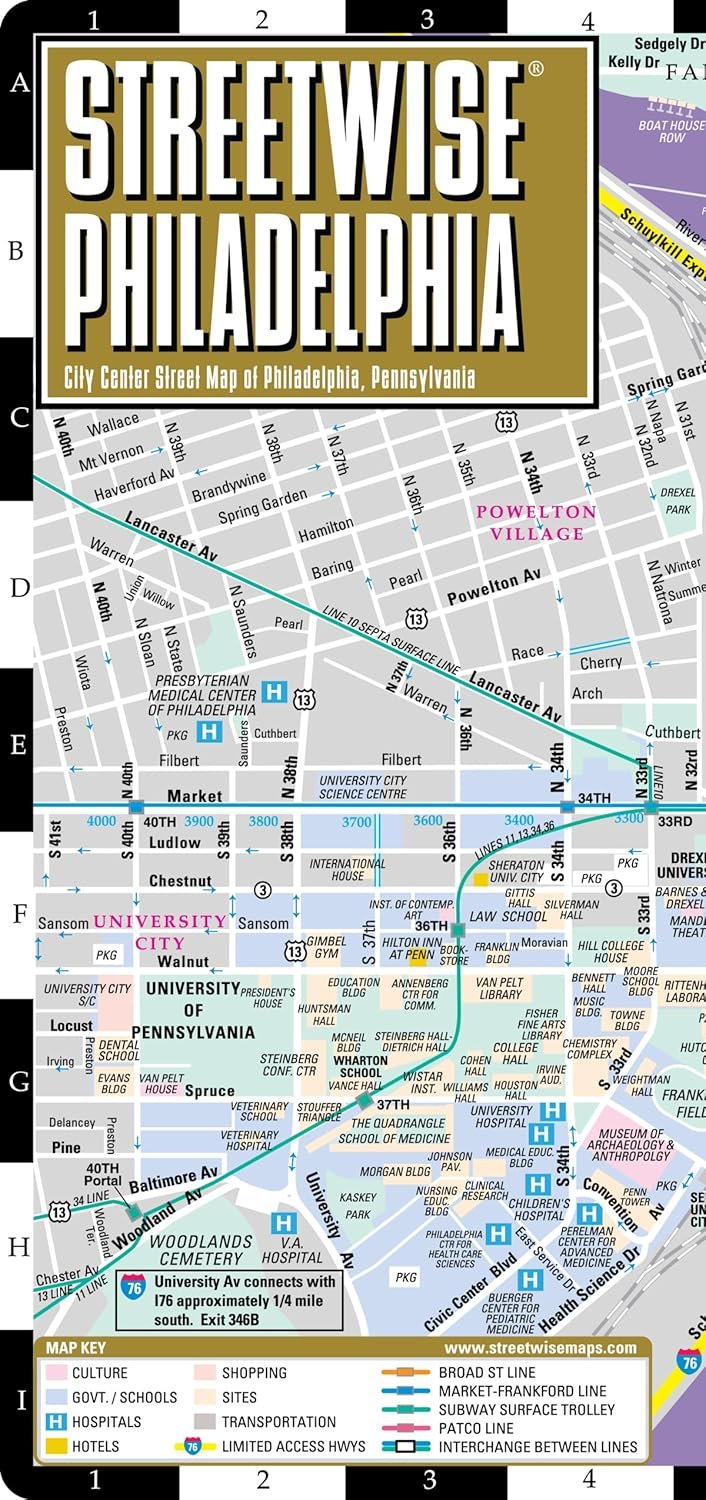
Navigating the vibrant city of Philadelphia has never been easier than with the Streetwise Philadelphia Map. This city center map is meticulously designed to cater to both tourists and locals alike. With a convenient accordion-fold format, it's perfectly sized to fit in your pocket while providing comprehensive insights into the city's layout and attractions.
The Streetwise Philadelphia Map features a laminated surface, ensuring that it withstands the elements while maintaining its clarity. When unfolded, the map measures 8.5" x 24", giving you ample space to plan your adventures. The critical coverage includes a detailed main map of Philadelphia at a scale of 1:14,000, which allows you to pinpoint attractions with ease.
In addition to the central map, this comprehensive travel tool provides a broad overview of the Greater Philadelphia area at a scale of 1:190,000. History enthusiasts will appreciate the detailed map of the Philadelphia Independence National Historical Park at a scale of 1:7,000, which highlights significant landmarks from America’s independence era.
For those relying on public transit, the Philadelphia Transit Map and the Center City Philadelphia Bus Map are integrated into the design, making this map not just a guide but a vital resource for navigating the city's transportation system. It includes all lines and stations of the SEPTA metro system, ensuring you can travel throughout the city efficiently.
Whether you’re planning to visit the historical sites, enjoy the rich culture, or explore the culinary delights of Philadelphia, having the Streetwise Philadelphia Map on hand is a must. It's more than just a map; it’s your personal guide to the City of Brotherly Love.