Picture this: you're standing in the shadow of General Sherman, the largest tree on Earth, with crisp mountain air filling your lungs and endless trails stretching into the horizon. Sequoia and Kings Canyon National Parks offer some of the most awe-inspiring landscapes in the U.S., from ancient sequoia groves to sheer granite cliffs plunging into deep canyons. But getting around these vast wildernesses without a solid map? That's where things can go sideways fast.
These parks span over 1,300 square miles of rugged Sierra Nevada backcountry. Trails twist through high alpine passes, dense forests, and remote wilderness areas like John Muir and Golden Trout. Without precise details on elevations, water sources, or regulations, even seasoned hikers risk getting turned around. Road access is limited, campgrounds are scattered, and weather can change in a heartbeat—making reliable navigation essential for safe, enjoyable trips.
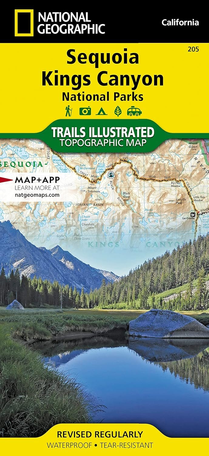
This Sequoia and Kings Canyon map (Trails Illustrated #205) is printed on Backcountry Tough waterproof, tear-resistant paper, so it withstands rain, sweat, and rough handling. At 1:80,000 scale, it provides unmatched topographic detail with contour lines, summit elevations, and a full UTM grid for GPS use. You'll find every major trail mapped out, including the iconic John Muir Trail, Pacific Crest Trail, and routes to Mt. Whitney—the highest peak in the lower 48.
Imagine plotting your day hike to Mist Falls or a multi-day trek through the High Sierra— this map makes it straightforward. Spot backcountry use zones, agency contacts, and park rules at a glance, reducing stress and boosting confidence. Its folded size (4.25" x 9.25") slips easily into a pack, unfolding to 37.75" x 25.5" for full overview. Whether you're summiting peaks, fishing alpine lakes, or just chasing viewpoints, it keeps you oriented amid breathtaking scenery.
Day trippers use it to find hidden groves; backpackers rely on it for permits and water crossings. I've pulled it out in drizzle to reroute around washed-out paths, and it held up perfectly. For anyone planning a California national parks trip, this map turns potential confusion into clear paths forward. Grab it, hit the trails, and let the parks reveal their secrets.